Damaging 60 MPH Winds With Frigid Temperatures And -20 Wind Chills In Utica/Rome
March is coming in like a lion! A strong cold front with damaging wind gusts and scattered snow squalls will move across Central New York this afternoon and evening. Lake effect snow showers will continue into Tuesday morning.
The Nation Weather Service out of Binghamton is calling for very active weather with rain showers this morning followed by scattered snow squalls this afternoon through this evening, strong to damaging winds this afternoon through tonight, and frigid temperatures tonight through Tuesday.

Wind Chill Advisory
Northern Oneida-Madison-Southern Oneida-Otsego-Delaware- Including Boonville, Hamilton, Oneida, Rome, Utica, Oneonta, Delhi, and Walton.
...WIND CHILL ADVISORY IN EFFECT FROM MIDNIGHT TONIGHT TO 10 AM
EST TUESDAY...
* WHAT...Very cold wind chills expected. Wind chills reaching 10 below to 20 below zero.
* WHERE...Oneida, Madison, Otsego, and Delaware counties.
* WHEN...From midnight tonight to 10 AM EST Tuesday.
* IMPACTS...The cold wind chills could result in hypothermia if precautions are not taken.
PRECAUTIONARY/PREPAREDNESS ACTIONS...
Use caution while traveling outside. Wear appropriate clothing, a hat, and gloves.
High Wind Warning
Madison-Southern Oneida-Otsego- Including the cities of Hamilton, Oneida, Rome, Utica, and Oneonta
...HIGH WIND WARNING IN EFFECT FROM 1 PM THIS AFTERNOON TO 10 AM
EST TUESDAY...
* WHAT...Northwest winds 25 to 35 mph with gusts up to 60 mph expected.
* WHERE...Madison, Southern Oneida, and Otsego counties.
* WHEN...From 1 PM this afternoon to 10 AM EST Tuesday.
* IMPACTS...Damaging winds will blow down trees and power lines. Widespread power outages are possible. Travel will be difficult, especially for high-profile vehicles.
* ADDITIONAL DETAILS...Winds will increase this afternoon and will be strongest this evening through tonight.
PRECAUTIONARY/PREPAREDNESS ACTIONS...
People should avoid being outside in forested areas and around trees and branches. Use caution if you must drive.
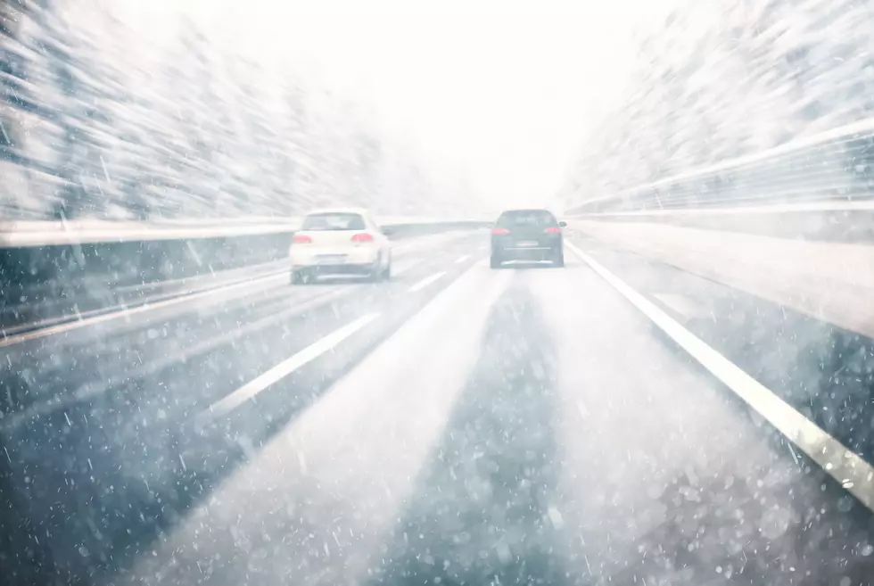
Scattered snow squalls are possible late this afternoon into the evening. Any squalls will potentially cause rapid changes in road conditions, low visibility, and up to a quick inch of snow. Timing for these snow squalls is mid-afternoon (around 3PM) into the evening (around 9-10PM). This will be especially problematic for this evening`s commute.
National Weather Service out of Binghamton says:
Of greater concern is a secondary Arctic front that will push through the area this afternoon into the evening. This strong Arctic front will create three hazards: scattered snow squalls (this afternoon into this evening), strong to damaging winds (this afternoon through early Tuesday morning), and bitter cold temperatures with dangerous wind chills tonight. As the squalls diminish in intensity by the late evening, lake effect snow showers then persist in Central NY through early Tuesday morning.
We'll see strong and damaging winds impact the majority of the area this afternoon through tonight. Damaging winds (occasional wind gusts up to 60 mph) will be possible across portions of Madison, southern Oneida, and Otsego counties. Winds will increase this afternoon and be strongest this evening through tonight.
Behind the Arctic front, an anomalously cold airmass will spill into the area. Low temperatures tonight are expected to be in the lower single digits to lower teens, with the single-digit readings mainly over Oneida-Madison counties-the Catskills. Winds will be an issue overnight as the combination of the cold temperatures, and the high winds will create dangerous wind chills of 15 below to 20 below zero.
Extended Forecast:
Today: A chance of rain showers before 11am, then a chance of rain and snow showers between 11am and noon, then a chance of snow showers afternoon. Cloudy, with a temperature falling to around 29 by 5pm. Breezy, with a west wind of 15 to 25 mph, with gusts as high as 41 mph. Chance of precipitation is 50%. Total daytime snow accumulation of less than one inch possible.
Tonight: Snow showers likely, mainly before 11pm. Mostly cloudy, with a low around 8. Wind chill values as low as -12. Windy, with a northwest wind 23 to 26 mph, with gusts as high as 47 mph. Chance of precipitation is 60%. New snow accumulation of less than one inch possible.
Tuesday: Mostly sunny, with a high near 24. Wind chill values as low as -12. Northwest wind 13 to 18 mph, with gusts as high as 38 mph.
Tuesday Night: Partly cloudy, with a low around 18. Southwest wind 3 to 6 mph.
Wednesday: A slight chance of rain and snow showers before 3pm, then a slight chance of rain showers between 3pm and 4pm, then a slight chance of rain and snow showers after 4pm. Partly sunny, with a high near 40. West wind 7 to 9 mph. Chance of precipitation is 20%.
Wednesday Night: A chance of snow showers, mainly between 7pm and 1am. Mostly cloudy, with a low around 24. Chance of precipitation is 40%.
Keep Up-To-Date
Take us everywhere you go with our new App. Listen live with all of your favorite shows with fewer commercials. The new app lets you call, message or tweet at us anytime or send us photos and videos. The app also gives you the ability to receive notifications about breaking news, weather alerts, traffic advisories and school closings happening in and around Central New York.
Winter Weather Preparation:
- Keep your cell phone charged, and make sure you know where your backup power supply is.
- Make sure all your flashlights have fresh batteries.
- Fill your gas tank. You can use your car to keep warm and recharge devices.
- Have some food available that you don’t need to cook.
**FOR POWER OUTAGES:
Get up to information on power outages throughout Central New York, where it’s out, and when it’ll be restored with National Grid’s Power Outage Map.
National Grid also offers text alerts on the latest efforts to restore power.
To receive free text message alerts and updates, text the word STORM to NGRID (64743). E-mail alerts are available to customers who create an online profile on the company’s website. All alert services can be started and stopped at the customer’s request.
You can even report power outages or get the latest information on National Grid’s website.

The 100 Best Places to Live on the East Coast
More From 96.1 The Eagle


