CNY At Increased Risk For Wind And Tornado Hazards
Meteorologists at NOAA NWS Storm Prediction Center has increased the chances for both WIND and TORNADO hazards this afternoon and evening.
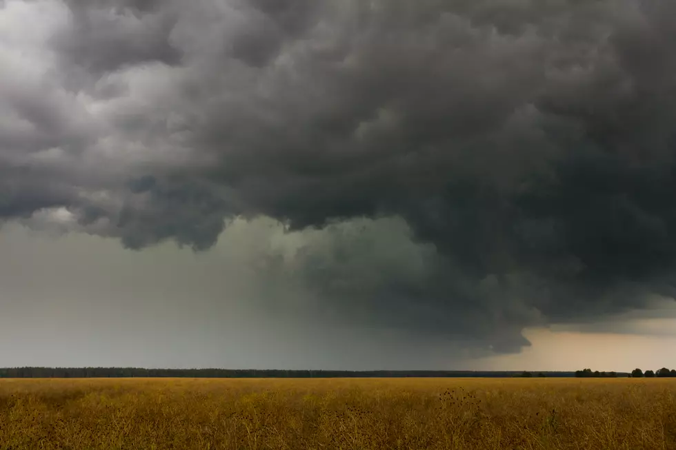
A strong low-pressure system is expected to impact the region later today through Friday with very strong winds, heavy rain and thunderstorms.
The Storm Prediction Center says there's an enhanced risk of severe thunderstorms today and tonight. An extensive squall line of strong to severe thunderstorms is expected to develop near and east of the Appalachians from parts of New York to the Carolinas. At least a few tornadoes and scattered to widespread damaging winds are possible.
The severe threat will diminish during the late evening to overnight given an increasing dearth of surface-based instability with east/northeast extent.
The first impact will be the threat for strong to possibly severe
storms and heavy rain later today.
This system will deepen rapidly today and develop into a fast-moving cold front spreading across the region. The cold front should supply enough force for a line of strong convection which will track quickly to the east across PA and s-central NY later this afternoon and evening. The main threat with these storms will be strong/damaging gusts. Could see gusts within this convective line around 40 to 50 mph or higher.
The secondary threat will be heavy rain, leading to flash flooding.
Given the generally saturated soils over certain parts of the area, and the rain from last night...a quick 1-2 inches with locally higher amounts...the threat for flash flooding will be elevated today and tonight. Poor drainage and urban areas have the highest threat, with smaller creeks and streams a close second. The Flood Watch remains unchanged at this time.
We will see very strong sustained west winds. The strongest winds will be over central NY...maximizing out across the lake plain into the wrn Mohawk Valley 30 to 40 mph...gusting 50 to 60 mph. A High Wind Warning has been issued for the nrn Finger Lakes over to Oneida and Madison Counties.
...FLOOD WATCH REMAINS IN EFFECT THROUGH FRIDAY EVENING...
The Flood Watch continues for
* Portions of central New York and northeast Pennsylvania, including the following areas, in central New York, Broome, Chenango, Cortland, Delaware, Madison, Northern Oneida, Otsego, Southern Oneida, and Tioga. In northeast Pennsylvania,Bradford, Northern Wayne, and Susquehanna.
* Through Friday evening
* Periods of heavy rain are possible this evening, especially along a line of thunderstorms. Total rainfall amounts of 2 to 3 inches are likely in the watch area, with locally higher amounts possible.
* Flooding could quickly develop along creeks, small streams, urban and in other low lying areas. Ponding of water on roadways is likely to occur. Significant rises are also expected on area rivers. A few of the headwater points on the main stem rivers are forecast to be above action stage and near minor flood stage by Friday.
...HIGH WIND WARNING REMAINS IN EFFECT FROM 4 AM TO 6 PM EDT
FRIDAY...
* WHAT...West winds 25 to 35 mph with gusts up to 60 mph expected.
* WHERE...Seneca, Northern Oneida, Onondaga, Madison, Southern Oneida, Yates and Southern Cayuga counties.
* WHEN...From 4 AM to 6 PM EDT Friday.
* IMPACTS...Damaging winds will blow down trees and power lines. Widespread power outages are expected. Travel will be difficult, especially for high profile vehicles.
PRECAUTIONARY/PREPAREDNESS ACTIONS...
People should avoid being outside in forested areas and around trees and branches. If possible, remain in the lower levels of your home during the windstorm, and avoid windows. Use caution if you must drive.
National Grid also offers text alerts on the latest efforts to restore power.
To receive free text message alerts and updates, text the word STORM to NGRID (64743). E-mail alerts are available to customers who create an online profile on the company’s website. All alert services can be started and stopped at the customer’s request.
You can even report power outages or get the latest information at National Grid’s website.
Power Outage Preparation:
*Keep your cell phone charged and make sure you know where your backup power supply is.
*Make sure all your flashlights have fresh batteries.
*Fill your gas tank. You can use your car to keep warm and recharge devices.
*Have some food available that you don’t need to cook.
* Download The Eagle App. You’ll receive local alerts, weather reports and more with push notification.
More From 96.1 The Eagle