Mid Week Snow & Ice Storm Could Have Major Impact on Central New York
Hope you enjoyed the unseasonably warm temperatures. Winter is coming back in a big way to Central New York. It's not just snow either. There's potential for heavy, accumulating sleet and freezing rain by midweek.
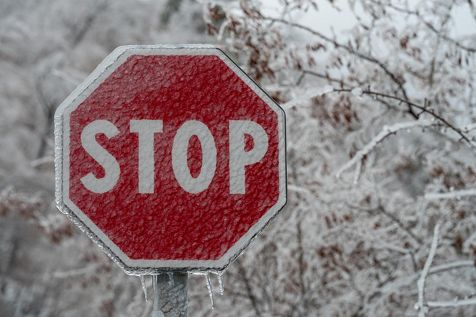
The next storm system may bring a little bit of everything Old Man Winter has to offer - snow, sleet, freezing rain, and rain late on Wednesday, February 22 through Thursday, February 23.
The National Weather Service says it could be the tale of two storms depending on where it hits in Central New York. Some may just see rain while others may be dealing with an icy mess.
South of this boundary, temperatures will quickly warm and allow any wintry mix to change to plain rain. But north of this boundary, a wintry mix looks likely, with possibly moderate impact ice accumulations.
Temperatures will remain in the 40s to kick off the week but will dip below freezing a few days later, turning any rain into ice. Good for the Ice Castles in Lake George that have struggled to stay open during this mild winter. Bad for drivers struggling to get to and from work and even worse for tree limbs and power lines.
Long Range CNY Forecast
Monday: Showers likely, mainly between 8 AM and 1 PM. Mostly cloudy, with a high in the mid-40s.
Monday Night: A slight chance of snow showers after 3 AM. Mostly cloudy, with a low in the upper 20s.
Tuesday: Rain and snow likely, becoming all rain after 10 AM. Mostly cloudy, with a high in the low 40s. Breezy, with 30 mph wind gusts.
Tuesday Night: Rain and snow showers likely before 7 PM. Mostly cloudy, with a low around 25. Breezy, with gusts as high as 33 mph.
Wednesday: A chance of snow after 1 PM. Mostly cloudy, with a high near 35.
Wednesday Night: Snow before 1 AM, then freezing rain. Low around 29. Chance of precipitation is 100%.
Thursday: Freezing rain before 1 PM, then a chance of rain. Highs in the upper 30s.
Thursday Night: Rain and snow showers likely before 2 AM, then a chance of snow showers. Mostly cloudy, with a low around 20.
Friday: A chance of snow showers before 8 AM Mostly cloudy, with a high near 22. Blustery.
Friday Night: Mostly cloudy, with a high in the low 20s. Blustery.
Saturday: A chance of snow. Mostly cloudy, with a high near 30.
Saturday Night: A chance of snow. Cloudy, with a low around 27.
Sunday: A chance of rain and snow showers. Mostly cloudy, with a high near 38.