Snow Emergency For Utica Begins At 5 PM Today
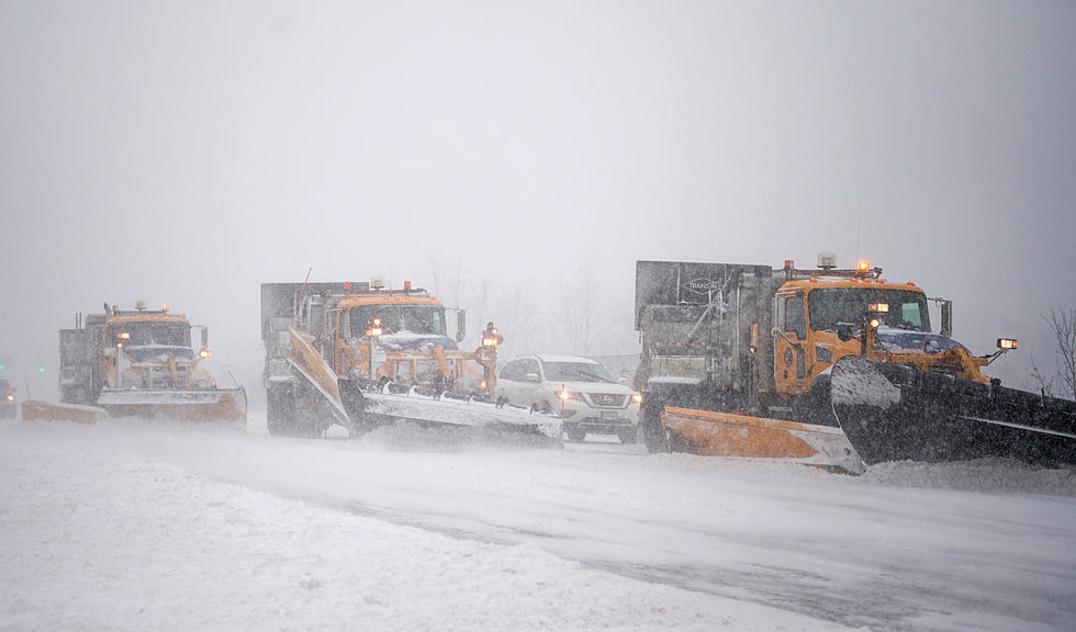
The City of Utica Snow Emergency that was scheduled for noon today has been moved to 5 pm and will remain in effect until further notice. Vehicles left on City roads after 5 pm are subject to ticketing and towing at owner's expense.
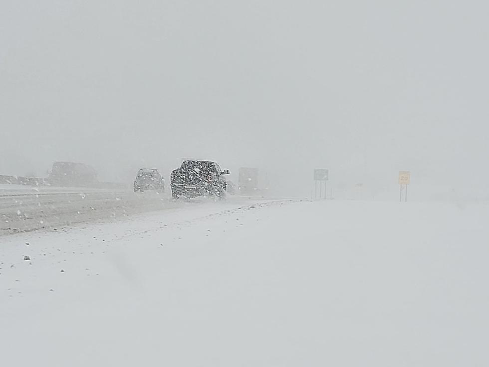
All vehicles must be off the streets by 5 pm to allow for safe passage for snow removal and emergency vehicles. Vehicles left on City roads after 5 pm are subject to ticketing and towing at owner's expense. They ask for no unnecessary travel on City streets as there could be dangerous travel conditions and warn of potential power outages due to the heavy snow.
The forecast from the National Weather Service out of Binghamton has downgraded the severity of the winter storm in our area from a Winter Storm Warning to a Winter Weather Advisory until 4 am tomorrow.
* WHAT...Snow. Additional snow accumulations of 2 to 5 inches.
* WHERE...In Pennsylvania, Susquehanna and Wyoming Counties. In
New York, Northern Oneida, Madison, Southern Oneida, Chenango
and Broome Counties.
* WHEN...A round of snow will move into the area by noon and last
until early evening. Snow will taper to snow showers early
tomorrow morning.
* ADDITIONAL DETAILS...Plan on difficult travel conditions, this
afternoon and evening. Winds gusting as high as 25 mph will
cause areas of blowing and drifting snow.
Governor Andrew M. Cuomo has issued a Travel Advisory for all areas east of I-81 as well as a travel ban on tractor trailers on certain roads. Find the full story here.
The National Weather Service says:
A major winter storm will impact the region today and tonight. Areas east of Interstate 81 will see the heaviest snow. Snow accumulations in the Poconos, Catskills and eastern Otsego County in New York will be between 6 and 16 inches by Thursday
morning. Lesser snow amounts will occur farther west tapering off to only a few inches in the Finger Lakes and Central Southern Tier of New York. From Thursday to Friday night snow showers with light accumulations will be prevalent mostly in
central NY.
Today: Snow. High near 35. East wind 9 to 13 mph. Chance of precipitation is 90%. Total daytime snow accumulation of around 2 inches.
Tonight: Snow, mainly before midnight, then snow showers likely after midnight. Low around 28. East wind 5 to 7 mph becoming west after midnight. Chance of precipitation is 80%. New snow accumulation of around 3 inches.
Thursday: Snow showers likely. Cloudy, with a high near 34. West wind 6 to 13 mph. Chance of precipitation is 70%. New snow accumulation of around 2 inches.
Thursday Night: Snow showers likely. Cloudy, with a low around 26. West wind 5 to 7 mph. Chance of precipitation is 70%. New snow accumulation of around 2 inches.
Friday: Snow showers likely. Cloudy, with a high near 34. West wind 6 to 9 mph. Chance of precipitation is 70%.
Friday Night: Snow showers likely. Cloudy, with a low around 28. Chance of precipitation is 60%.
Saturday: A chance of snow showers. Mostly cloudy, with a high near 34. Chance of precipitation is 30%.
Keep Up To Date
Take us everywhere you go with our new App. Listen live with all of your favorite shows with fewer commercials. The new app lets you call, message or tweet at us anytime or send us photos and videos. The app also gives you the ability to receive notifications about breaking news, weather alerts, traffic advisories and school closings happening in and around Central New York.
Winter Weather Preparation:
- Keep your cell phone charged and make sure you know where your backup power supply is.
- Make sure all your flashlights have fresh batteries.
- Fill your gas tank. You can use your car to keep warm and recharge devices.
- Have some food available that you don’t need to cook.
- Download the App. You’ll receive local alerts, weather reports and more with push notifications.
BONUS VIDEO:
More From 96.1 The Eagle